Our Achievements
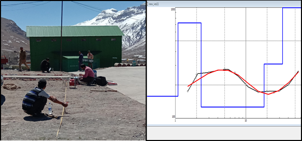
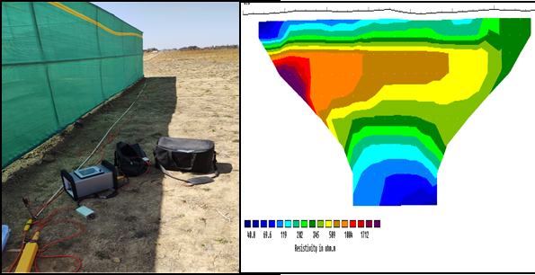
Project:- Detection of ground water table at various Border Outposts of ITBP on the Indo China Border Areas in the State of Uttarakhand & Himachal Pradesh.
Expertise Employed:- Geo-Electrical Resistivity Testing (ERT) using Aquameter CRM AUTO C Aquameter, a highly precise Resistivity meter.
Conclusion:- Successfully demarcated sub-surface Lithology and ground water availability to a depth of 50meter below surface level.
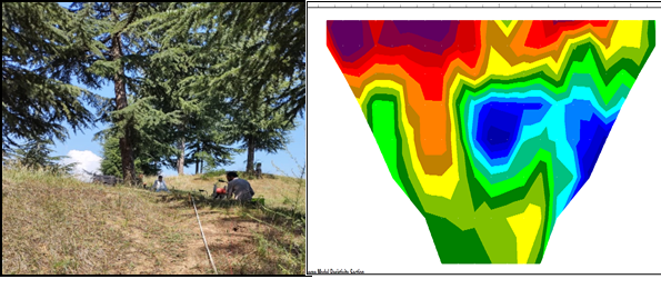
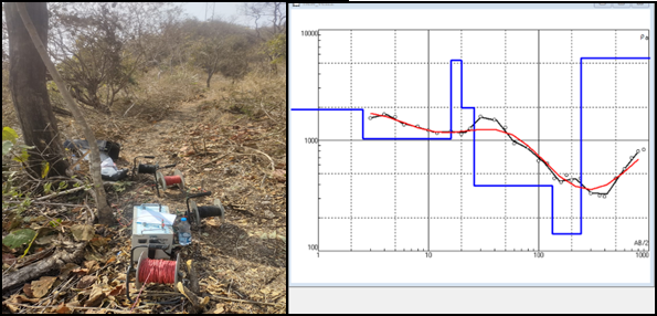
Project:- Geophysical Electrical Resistivity (ERT) Survey along Baramulla-Gulmarg road in Kashmir as part for Preparation of Detailed Project Report (DPR) allotted by National Highways and Infrastructure Development Corporation Ltd. (NHIDCL).
Expertise Employed:- Geo-Electrical Resistivity Testing (ERT) using Aquameter CRM AUTO C Aquameter, a highly precise Resistivity meter.
Conclusion:- Successfully demarcated the configuration of the boundary zones, saturation level of soil and overburden material, identify rock line and slip surface.
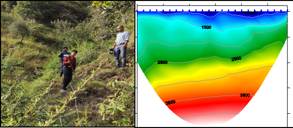
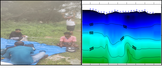
Project:- Geophysical Seismic Refraction Tomography (SRT) Survey Sudhmahadev-Dranga Tunnel in Jammu & Kashmir as part for Preparation of Detailed Project Report (DPR) allotted by National Highways and Infrastructure Development Corporation Ltd. (NHIDCL).
Expertise Employed:- Seismic Refraction Tomography (SRT) survey using P.A.S.I. GEA24, A compact-sized 24-channel fully digital seismograph.
Conclusion:- Successfully demarcated subsurface geologic conditions and to provide the general soil types and the approximate depth of strata boundaries, or to bedrock.
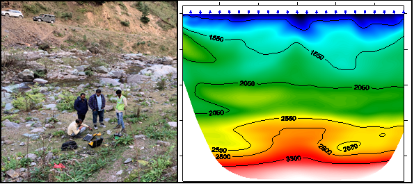
Project:- Geophysical Seismic Refraction Tomography (SRT) Survey Vailoo Tunnel in Jammu & Kashmir as part for Preparation of Detailed Project Report (DPR) allotted by National Highways and Infrastructure Development Corporation Ltd. (NHIDCL).
Expertise Employed:- Seismic Refraction Tomography (SRT) survey using P.A.S.I. GEA24 , a compact-sized 24-channel fully digital seismograph.
Conclusion:- Successfully demarcated subsurface geologic conditions and to provide the general soil types and the approximate depth of strata boundaries, or to bedrock.
Project:- Underground Utility Mapping Survey at JLN Marg in Jaipur City for subway Connecting SMS Medical College and Bangar Hospital, Jaipur, Rajasthan for L & T Infrastructure Engineering Ltd.
Expertise Employed:- Underground Utility mapping survey using GSSI SIR-3000 Ground Penetrating Radar (GPR) & Cable and Pipe Line Locator.
Conclusion: - Successfully detected underground utilities (Cables & pipelines) and submitted a satisfactory report.
Project:- Underground Utility Mapping Survey at many cities of Rajasthan as Churu, Nagaur, Pratapgarth, Bikaner, Khetri, Mandawa, and Banswara under a part of Rajasthan Urban Infrastructure Development Project (RUIDP).
Expertise Employed:- Underground Utility mapping survey using GSSI SIR-3000 Ground Penetrating Radar (GPR) & Cable and Pipe Line Locator.
Conclusion: - Successfully detected underground utilities (Cables & pipelines) and submitted a satisfactory report.
Project:- Underground Utility Mapping Survey in Maharjgunj & Ratnapark area of Kathmandu, Nepal for HT/LT UG Project under Nepal Electricity Authority (NEA) UG Project for KEI Industries Ltd.
Expertise Employed:- Underground Utility mapping survey using GSSI SIR-3000 Ground Penetrating Radar (GPR) & Cable and Pipe Line Locator.
Conclusion: - Successfully detected underground utilities (Cables & pipelines) and submitted a satisfactory report.
Project:- Underground Utility Mapping Survey at Gurugram, Haryana for SKN. Haryana City Gas Distribution Pvt. Ltd. under smart city projects, Gurugram Municipal Development Authority (GMDA).
Expertise Employed:- Underground Utility mapping survey using GSSI SIR-3000 Ground Penetrating Radar (GPR) & Cable and Pipe Line Locator.
Project:- Underground Utility Mapping Survey, Topographical Survey & Geotechnical Survey at major junctions for traffic solution & beatification works in Jaipur, Rajasthan for Sincere Architects Engineers Pvt. Ltd. under Jaipur Development Authority Projects.
Expertise Employed:- Underground Utility mapping survey using GSSI SIR-3000 Ground Penetrating Radar (GPR) & Cable and Pipe Line Locator, Total Station used for Topographical survey and soil Samples collected from drilling.
Conclusion: - Successfully detected underground utilities (Cables & pipelines), all surface features mapped in Topographical drawing, and soil sample analysis report submitted with satisfactory results.
Conclusion: - Successfully detected underground utilities (Cables & pipelines) and submitted a satisfactory report.
Project:- Topographical Survey of Roads & Section and Traffic Count Survey at Jodhpur, for Sincere Architects Engineers Pvt. Ltd.
Expertise Employed:- Total Station used for Topographical Survey & Videography for Traffic count Survey.
Conclusion: - Successfully mapped surface features in Topographical map & Traffic counting and submitted a satisfactory report.
Project:- Underground Utility Mapping Survey at Kochi, Kerala for Six laning of Thuravoor-Paravoor section of New NH—66 in the State of Kerala on EPC Mode under Bhartmala Pariyojna.
Expertise Employed:- Underground Utility mapping survey using GSSI SIR-3000 Ground Penetrating Radar (GPR) & Cable and Pipe Line Locator.
Conclusion: - Successfully detected underground utilities (Cables & pipelines) and submitted a satisfactory report.
Project:- Ground Penetrating Radar Survey at CCS International Airport, Lucknow to estimate the thickness of subsurface pavement layers
Expertise Employed:- Underground Utility mapping survey using GSSI SIR-3000 Ground Penetrating Radar (GPR) .
Conclusion: - Successfully bifurcated subsurface pavement layers and submit satisfactory report.
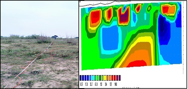
Project:- 2D-Geophysical Electrical Resistivity Tomography (ERT) Survey for Aquifer characterization at Samri mines, Chhattisgarh.
Expertise Employed:- 2D-Electrical Resistivity Tomography (ERT) using GD-10 Geomative multi electrode Electrical Resistivity Tomography Imaging System.
Conclusion:- Successfully demarcated the configuration of the boundary zones, saturation level of soil, water table and massive strata subsurface
Project:- Detection of ground water table for Proposed township Project at Rishikesh, Uttarakhand.
Expertise Employed:- Geo-Electrical Resistivity Testing using Aquameter CRM AUTO C Aquameter, a highly precise Resistivity meter.
Conclusion:- Successfully demarcated sub-surface Lithology and submit ground water availability report .
Project:- 2D-Geophysical Electrical Resistivity Tomography (ERT) Survey for saturation level of subsurface strata at Cuttack, Odisha.
Expertise Employed:- 2D-Electrical Resistivity Tomography/Imaging (ERT) using GD-10 Geomative multi electrode Electrical Resistivity Tomography Imaging System.
Conclusion:- Successfully demarcated the configuration of the boundary zones, saturation level of soil, water table and massive strata subsurface.
Project:- Geophysical Seismic Refraction Tomography (SRT) Survey for lithology of subsurface strata at Cuttack, Odisha.
Expertise Employed:- Seismic Refraction Tomography (SRT) survey using P.A.S.I. GEA24 , a compact-sized 24-channel fully digital seismograph.
Conclusion:- Successfully demarcated subsurface geologic conditions and to provide the general soil types and the approximate depth of strata boundaries, or to bedrock.